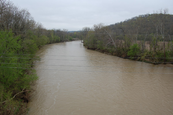
In Pieces of The Puzzle I wrote about the way the railroad was built on the towpath of the former Whitewater Canal after it went bankrupt from rampant flooding of the Whitewater River in the late 1840s and early 1850s. With the river never far away, spring flooding is always a concern when the region receives heavier than normal rainfall, such as we did in 2011. The photo below, taken from the highway bridge in Brookville shows much higher water levels in the river. The river had already crested by the time I shot this picture. The evidence was clearly seen in the discolored and flattened vegetation and standing pools of water along the low areas near the railroad right-of-way (not seen in this photo).
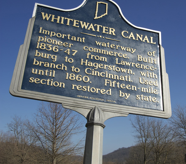
While the canal was completed and carried traffic, it was outdated technology. Railroads were progressing rapidly in other parts of the country, and railroad technology was gaining ground as a preferred means of reliable transportation. With the canal so susceptible to the vagaries of weather, and with travel times still measured in days, it’s little wonder it went bankrupt after a series of devastating floods wiped out large portions over several years. After bankruptcy, all rights to the towpath were sold to the Indianapolis and Cincinnati RR in 1863.
Side-by-Side
This relationship between the canal and the railroad is seen most clearly at Metamora IN, a small community located midway on the branch. In the 1970s another flood from the always present Whitewater washed out a portion of the former New York Central, now Conrail line between Brookville and Metamora. At the time traffic levels on the branch were such that repairs were never made to restore the right of way and to this day, the branch consists of two distinct, completely separated sections of track. I model the southern half, which consists of the main connection at Valley Jct. and points such as Cedar Grove and Brookville, where the Owens Corning shingle plant that keeps the branch going is located.
The northern portion is owned and operated by the Whitewater Valley Railroad, a tourist only line headquartered in Connersville IN, the one time northern terminus of the whole branch. The WVRR runs trains from its station near downtown Connersville, south to Metamora and back on weekends during the spring to fall tourist season. Tourism is the main economic engine in Metamora.
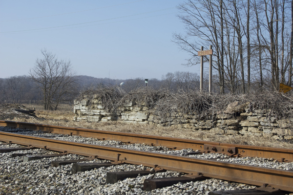
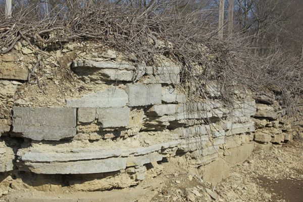
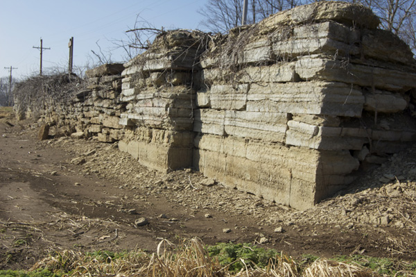
Following the line south from Connersville is easy since a state highway parallels the track most of the way. Between the towns of Nulltown and Alpine are the remains of two canal locks, which give a picture of how things used to look.
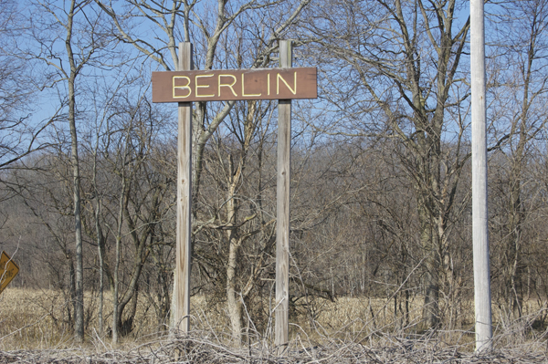
At more than a century and a half old, the stone work in these structures is still impressive in terms of mass and size. There are individual stones close to the weight of a modern small car and one wonders at the engineering, plus the animal and manpower required to set them back in the 1830s. The Berlin Lock is next to the road and accessible for closer study with the railroad running directly by on the former towpath where mules and draft horses once pulled large canal boats from Hagerstown and Cambridge City to Lawrenceburg IN and Cincinnati OH.
A destination
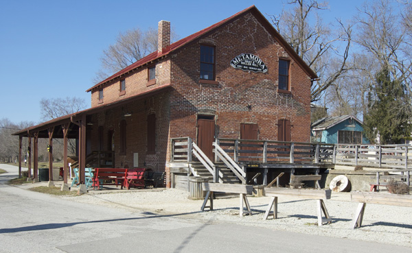
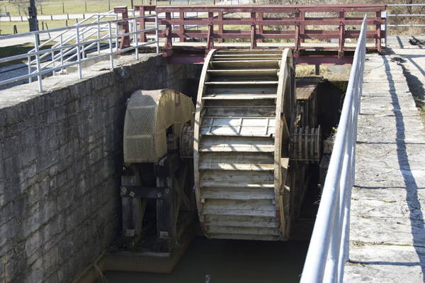
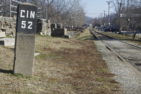
Metamora is the destination of the WVRR tourist trains, which deposits passengers in the middle of town. The restored Metamora Grist Mill is still in operation with water power as it was from day one. Here you’ll see how grains were milled into flour and other staples of early life. The track spans a drive shaft from an undershot waterwheel powered from the canal bed. A mile marker conveys it’s 52 miles from here to Cincinnati, presumably referring to Union Terminal.
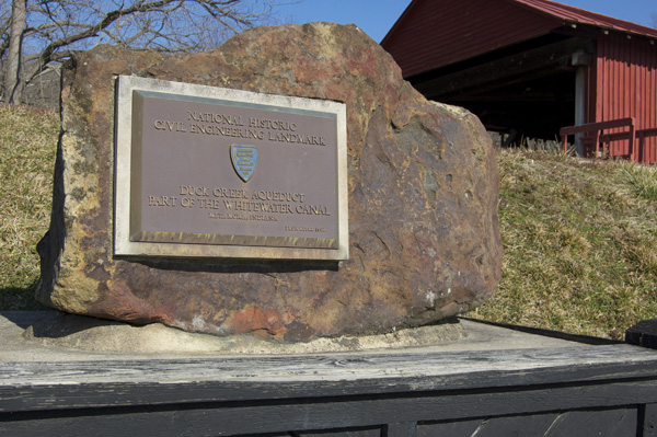
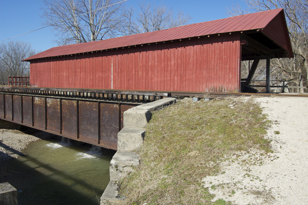
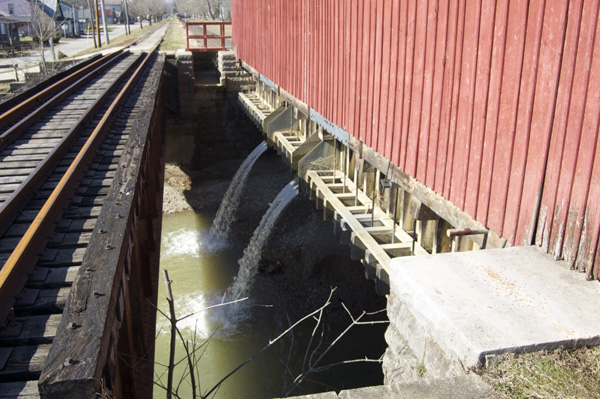
At Metamora the state of Indiana restored a portion of the old canal to operating condition, along with a fully functional lock and an aqueduct that carries the canal over Duck Creek (the only such structure in the country). When the canal was fully operational, there were 56 such locks along its 76 mile length that lowered the water level over 491 feet in elevation from Hagerstown to the ends at Lawrenceburg and Cincinnati.

Interior structure of Duck Creek Aqueduct featuring a Burr arch design commonly used for covered bridges in the area.
A lesson applied
As interesting as Metamora is, it isn’t on the portion of the line I chose to model. Furthermore, there’s no industry here but tourism and I didn’t have the desire to model the WVRR tourist train. This choice was a result of learning the hard way that not every interesting feature can be included on a layout and, some shouldn’t be no matter how model worthy they are. Because we’re constantly told that space for any layout is at such a premium, it’s always tempting to include as much as we can into a given area. Frankly, I’ve come to see this for the lie that it is. More is definitely not better in most, if not all, cases. Trying to stuff too many elements into a scene results in a toy-like appearance due to the excessive compression and crowding. While Metamora is visually interesting, it offered nothing in the way of operation.
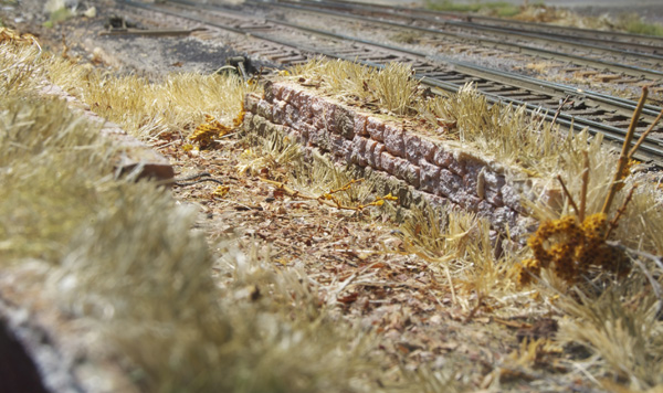
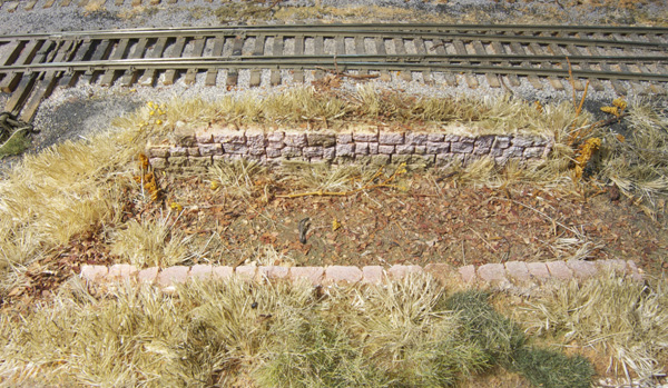
I wanted to pay tribute to the proximity of the railroad and canal and did so by modeling the stone work of an abandoned lock near the Mill St. area. While I’m satisfied with the freelanced scene, there is plenty of room for improvement. For one thing, the wall castings from Chooch are too pristine and tidy for such old stone work. Referring to the prototype photos of the Berlin Lock, the stone work should be much more decrepit looking, almost falling apart. The model lock is also severely compressed in length due to the lack of space. Were I to redo this scene, I would take these two things in to account and remedy both shortcomings.
Diving into the history of an area is a satisfying aspect of prototype modeling for me. I’ve gained a perspective beyond the surface of things, and an appreciation of why and how the part of Indiana I live in developed as it did. This depth of knowledge can be brought to the layout in helping me choose which elements to include and how they relate to each other. Compared to the typical one-of-this and some-of-that approach, it’s a no-brainer.
Regards,
Mike
Mike,
Excellent article! Like you, learning the history of the area is part of the fun of model railroading for me.
Matt
Thanks Matt. The more I study this little line, the more interesting it becomes.
Mike
Mike,
“The more I study this little line, the more interesting it becomes”.
I think this can be said for many small branchlines and towns throughout the USA. In my “neck of the woods”, I have the Stewartstown RR, remains of the Lancaster, Oxford, and Southern (3ft), Ma & Pa, EBT, Newport and Sherman Valley (3ft). All interesting in their own way. Finding out more about the history of one modeled building, or a certain bridge, or even one small town with an interesting industry makes the hobby that much more interesting.
Since seeing the picture on pg 11 of “Pieces of the Puzzle”, I thought you had a great project with a lot of character. Imagine building a station over the top of the canal, and the canal still has water in it! Interesting scene indeed!
Matt
Since seeing the picture on pg 11 of “Pieces of the Puzzle”, I thought you had a great project with a lot of character. Imagine building a station over the top of the canal, and the canal still has water in it! Interesting scene indeed!
Matt, you wouldn’t recognize that scene today. The canal and depot have disappeared, both replaced by yards of concrete parking lot and massive storage tanks, with a huge pink colored panther painted on one.
Regards,
Mike